Biodiversity, Water Resources and Climate Change Impacts in the Tropical Andes of Peru

Methodology
-
Methodology
The activities of the field trip program are organized in two components:
a. Lectures
Block I: The Peruvian coast
Explore climatic and ecosystemic features of the Pacific coast and Andean foothills (3 days).
The cold nutrient-rich Peruvian Sea represents one of the most productive marine ecosystems worldwide. Despite its latitudinal position close to the equator, the Peruvian coast represents one of the world’s driest deserts due to its special climatic settings. Therefore, species have to cope with high aridity. During austral winter, a special plant community develops at the Pacific Andean foothills, called Lomas formation. These fog oases are supplied by oceanic moisture and drizzle. Specific adaptations, resulting in high endemism, allow species to resist water scarcity and efficiently use the short wet season.
Block II: Tropical glaciers, water resources and related risks
Analyze high mountain areas and their key role for human welfare: tropical glaciers, water resources and Andean livelihoods (7 days).
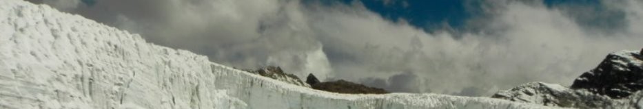
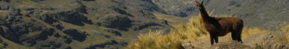
In the Tropical Andes almost all main rivers originate from glaciers with headwaters above 5000 m a.s.l. With around 500 km² glacier area, the Cordillera Blanca (Ancash, Peru) represents the largest tropical glacier mountain range worldwide but has been severely affected by massive ice loss corresponding to ~35% glacier area reduction in the last 40 years. As virtual water towers, glaciers have been a fundamental sustention of Andean and coastal livelihoods for thousands of years of human history. Direct glacier and high Andean lake water discharge constitute a vital continuous water supply for many settlements, agricultural irrigation, hydropower generation and mining use, particularly during the dry season. This natural buffering system of climate’s seasonality and variability is likely to deteriorate, triggered by allover retreating glaciers, shifts in climatic patterns but also changes in water allocation. Robust adaptation and integrative water management strategies including stakeholders are challenged by severe impacts from local and global change and resulting conflicts over water resources.
b. Field Trips, city tours and GIS-assisted learning:
The students will acquire expert knowledge in theoretical, practical and computer-assisted practice lessons additionally considering the cultural background of Peru. Applied features of the course are:
- Pre-Colombian Peruvian history: National Museum of Arqueology, Anthropology and History, Pueblo Libre, Lima
- City center tour: go back in time and explore old colonial and republican Lima
- Coastal climate and biodiversity: Lomas de Lachay fog oases at the Pacific Andean foothills
- Tropical Glaciers: trip to Pastoruri (~5200 m a.s.l.), one of the emblematic Cordillera Blanca glaciers and its surroundings (colored lake, Puya raimondii plants, etc.)
- Glacier lakes: Palcacocha lake (4566 m a.s.l.), risk analysis and current monitoring efforts
- Use of Andean water resources: visit of the 263 MW Cañon del Pato hydropower plant
- High mountain risks: visit of the Glacial Lake Outburst Flood – Early Warning System (GLOF-EWS) control center at Carhuaz
- Applied change detection in high mountains: GIS-assisted analysis of glacier and lake changes in the Peruvian Andes
Suscribe for updates
Syllabus 2016
Organizer
PUCP Mining Engineering School
LocationLima and Huaraz (Cordillera Blanca, Ancash)
Period12 days
Session DatesJuly 9th to July 20th
Credits
6 credits
Language of InstructionEnglish
LecturersFabian Drenkhan, Diploma (M.Sc.) in Physical Geography by University of Stuttgart, Germany.
Martín Timaná, Ph.D. in Plant Biology from the University of Texas at Austin, USA.