Privado: Structural Diagnosis of Archaeological Monumental
Complementary Information
Outcomes
By the end of the program, students will be able to conduct:
3D reconstruction using unmanned aerial vehicles
- Proper operation of unmanned aerial vehicles (UAV)
- 3D reconstruction of diverse structures
- Use of commercial 3D software, image processing and solid modelling.
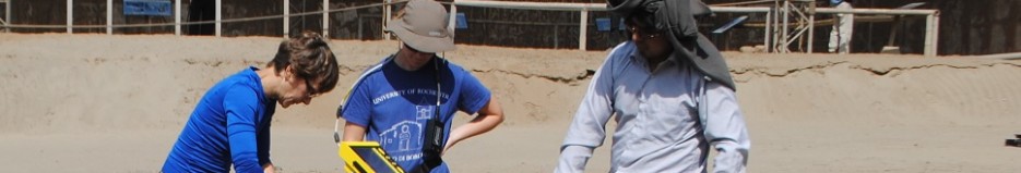
Geophysical/geotechnical assays: application of ground penetrating radar and superficial waves for archaeological and geotechnical engineering studies.
Ground penetrating radar
- Determination of stratigraphic soil profile
- Detection of buried objects
- Localization of ground water level
Surface waves
- Characterization of soil property dynamics
- Determination of soil shear wave velocity profil
Non-destructive tests for structural characterization:
Modal analysis
- Determination of most appropriate location to install vibration measurement systems (accelerometers)
- Signal processing for the determination of modal forms and frequencies
- Calibration of numerical models based on obtained results
Thermography
- Detection of anomalies in structural elements (cracks, fissures and cavities)
- Location of areas with higher humidity concentration
Methodology
During the first week, students will attend classes at PUCP to give them a basic understanding of structure engineering principles, monumental architecture, geophysics, and non-destructive experimental techniques. Simultaneously, students will be conducting experiments in the campus laboratories.
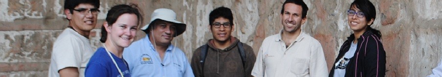
For the following two weeks, students will be carrying out activities in the field. The first week will be spent in the archaeological site of Huaca de la Luna, while the second week will take place in the ruins of the colonial town of Zaña.
The activities have been developed in the following manner:
3D reconstruction using unmanned aerial vehicles:
The methodology for photogrammetric reconstruction work consists of the following steps:
- Establish the protocol with which the images for the chosen case study will be taken. Said protocols should prioritize influential features in the reconstruction process as the overlap between each photograph, the lighting of the object under study, the internal geometric characteristics of the camera (focal length, pixel size and position of the principal point), avoiding the optical distortion of the image with an appropriate position of the camera.
- Devise states should be verified (UAV, batteries, control, camera). It should be noted that the UAV batteries are short, so you must also locate a strategic place to initiate the takeoff UAV.
- The picture will be performed using the UAV. This process should take into account the protocol chosen for the case study.
- Images will be processed to obtain a 3D database, 3D reconstruction and solid model. The requires a computer with 12 GB of RAM to process smoothly the 200-300 photographs, 2GB of RAM will be sufficient to process 20 to 30 photographs.
Geophysics assays:
Application of ground penetrating radar and surface waves for archaeological and geotechnical engineering studies
Ground penetrating radar
The GPR equipment utilized for the measurement of subsurface conditions normally consists of a transmitter and receiver antenna since 10 MHz to 1.5 GHz, a radar control unit, and suitable data storage and display devices. A circuit within the radar control unit generates a train of trigger pulses that are sent to the transmitter and receiver electronics. The transmitter electronics produce output pulses that are radiated into the ground from the transmitting antenna. (ASTM-D6432).
Data acquisition for GPR surveys includes common offset and common midpoint profiling. Common midpoint profiles sample the same point in depth below the midpoint, and the reflection hyperbola which results from the varying source-receiver separation can be used to determine the velocity of the subsurface layer.
Surface waves test
The surface-waves test is widely used in geophysics to infer a shear wave velocity model of the subsoil for a wide variety of applications. The standard procedure for surface waves test can subdivided in three main steps:
- Acquisition of experimental data (row data): Surface wave data are typically collected on the surface using a variable number of receivers (accelerometers or geophones) which can be deployed both with one-dimensional geometries. The number of receiver and the offset will be defined by the specialist and it will depend of the survey depth. The acquisition and storage of signal can be used a dynamic signal analyzers (DAQ) connected to PC or laptop. A sledge hammer is used for generation of the wavefield.
- Signal processing for obtain the experimental curve: This is to obtain the relationship between phase velocity and frequency. The different procedures apply a variety of signal analysis tools, mainly based on the Fourier Transform.
- An inversion process to estimate the shear wave velocity profile at the site: Assuming a model for the soil deposit, model parameters that minimize an object function representing the distance between the experimental and the numerical dispersion curves are identified Inversion.
Non-destructive tests for structural characterization: modal analysis and thermography
Modal analysis
The first step in this technique is to build a numerical model of structure in study. This model is used to determine the best location to install the accelerometers. Depending on the number of accelerometers different arrangements will be done, at least two. After installing the accelerometers for each arrangement vibration, data will be recorded. Collected data will be processed to identify modal forms and natural frequency of the structure using ARTEMIS software. If possible, a more detailed numerical model will be done and calibrated.
Thermography tests
Thermography tests are based on the thermal conductivity of a material and may be passive or active. The first step for survey with this technique is to locate the thermographic camera at the desired location and distance from the structure or specimen of interest. It is necessary to use an appropriate infrared imaging measurement to measure and compensate for the reflected temperature error incident upon the specimen. The test must be performed at least three times.
Suscribe for updates
Download Syllabus
Location:
Trujillo – La Libertad, Perú
Time Period:3 weeks
Number of hours:135 hours
Credits:4
Professor:PhD. Rafael Aguilar
Associated Professors:PhD. Benjamin Castañeda
PhD. Renato Perucchio
PhD. Cynthia Ebinger
PhD. Miguel Pando
Msc. Guillermo Zavala